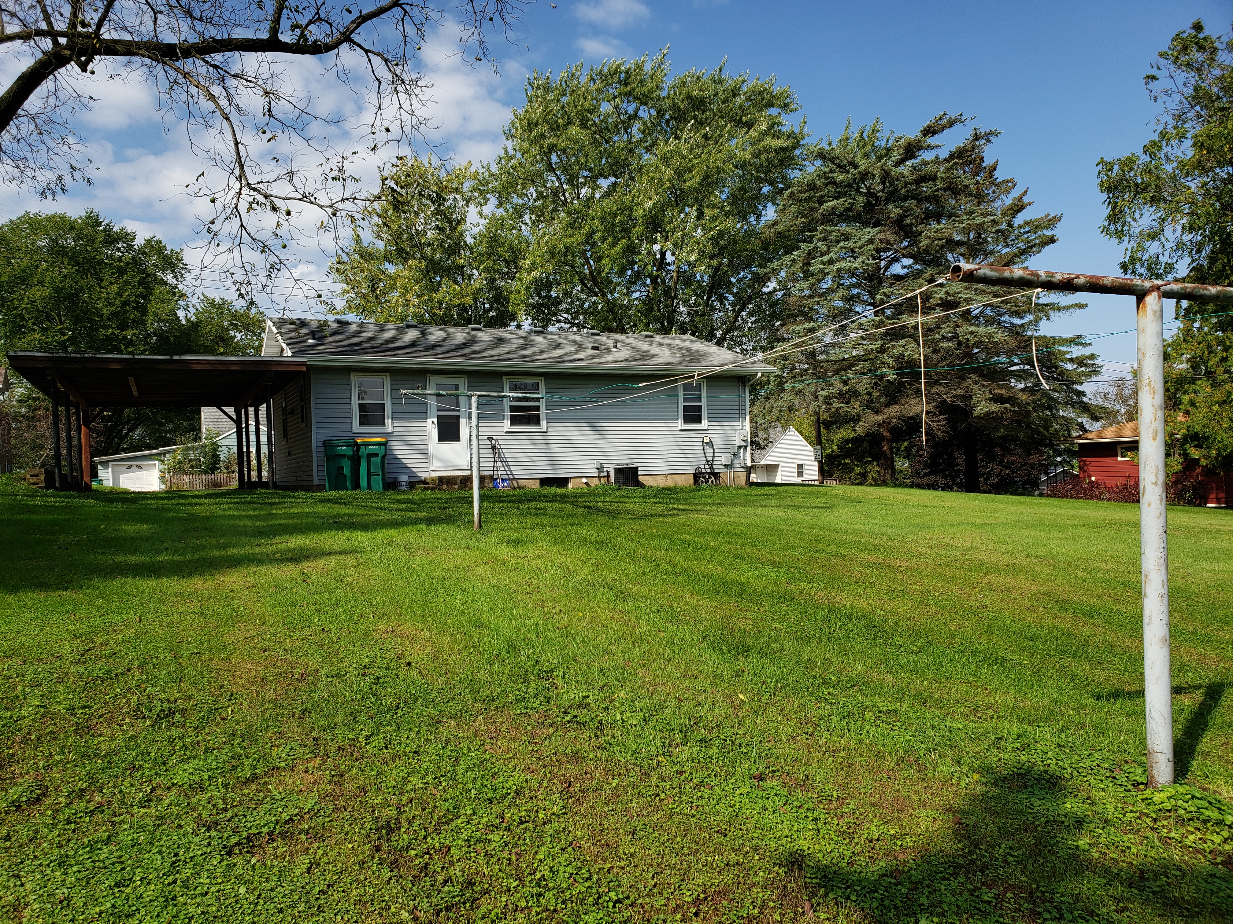
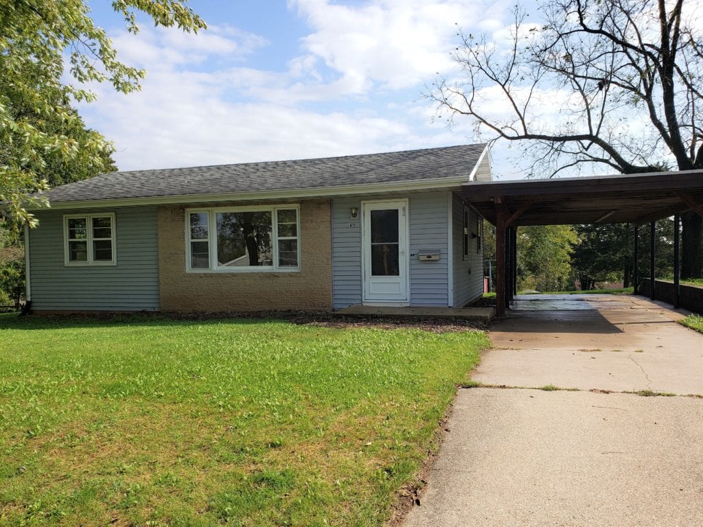
My buyer client was interested in purchasing this property. His only request in the Offer to Purchase was for the seller to mark the lot lines. The listing description said there were two lots, but it was not obvious where each lot was, nor where the perimeter of both lots were.
We tried to locate any survey markers without too much ground disturbance, but didn’t find any. (Later, my client returned with a metal detector, but could not locate them.) Then we went next door and asked the neighbors if they knew where their lot line was. But they were not sure and didn’t want to assume where it might be.
Finding Lot Information
I checked to see if any documents were included with the listing. The MLS sheet said the property included “Lake Park Lots 6 & 7,” and that the lot dimension was 120′ x 150′. However, there were no property maps included that specifically showed where to start measuring and if each lot was the same dimension. I went online to see if the Village had online information about this parcel. (See Drawing below) I also searched other online land records, but could not find information about each lot, only the double lot.
[Lot 6 is the double lot. Notice there is no Lot 7, so it is unclear if both lots are the same size.]
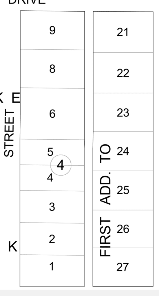
This map did not show enough information. So the next step is to visit the local clerk’s office to copy their property maps.
Register of Deeds
The Warranty Deed gives the parcel number and the description, but again, no measurements, just a file number. Following the description, you should be able to measure from named landmarks to determine the location of your boundaries. However, the description may rely on the location of a landmark that no longer exists. If the most recent deed for your property does not contain this sort of description, research an older deed.

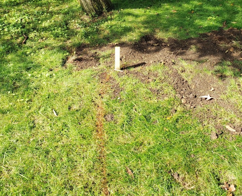
The seller dug down a bit and found this metal stake on the far corner of the property. It has red tape around it. It is important to note there are a few inches between the neighbor’s fence and the property line.
The seller used a measuring tape from this metal stake to 120′ (as noted in the documents) and marked the corner with a wooden stake.
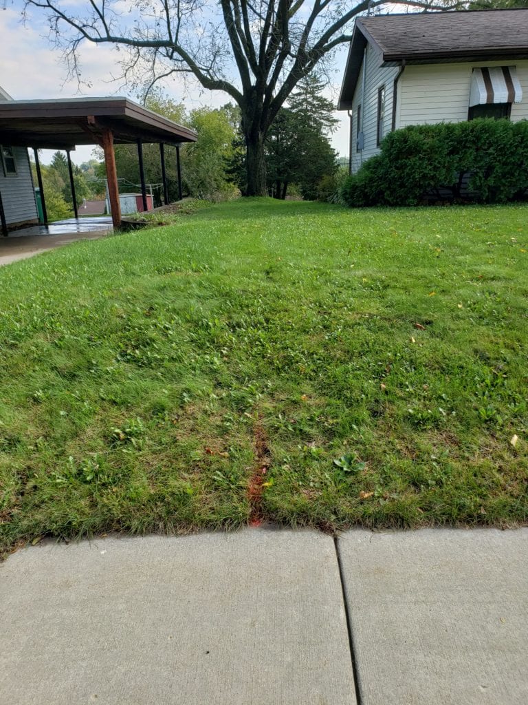
Then from the wooden stake, the seller measured 150′ to the sidewalk. It was easy to measure the final 120′ to complete the rectangle.
It seems the black walnut tree is barely on the new buyer’s property (left) rather than the neighbor’s property (right).
Note that a Certified Survey Map (CSM) was not done. A CSM will need to be done should the new buyer wish to subdivide the property.
Due Diligence
For properties such as this, a listing agent should check with the local governmental agency to copy the plat map showing the lot lines for either the individual lots, or conversely, if a document or survey map verifies the two lots were combined into one. Any relevant documents should be attached to the MLS listing for agents to show their prospective buyers.
Contact Premiere Stagers & Realty to meet your selling, buying, or staging needs. 608-345-9396